Phantom Trails of the Santiam Canyon
By J.D. Adams
By J.D. Adams
Unfolded before me is a Willamette National Forest map from 1937, rescued from obscurity with a portrayal of a dynamic landscape of unrefined power. The surging whitewater of Mt. Jefferson flowed unchallenged through a towering expanse of old-growth forest in a time before the Detroit and Big Cliff Dams. Here was a forest kingdom of few roads, ruled by trails ascending to ridgelines lost in the clouds. To complete this picture, I have gathered memories from generations who lived and worked in the historic Santiam Canyon.
The Santiam Highway was a single track, treacherous and forbidding, perched on the canyon wall where the Detroit Dam is today. The view dropping off into the canyon is still etched into the minds of old-timers. Turnouts were few, driving and negotiating skills were honed when two cars had to pass each other.
Detroit, originally named logging camp 17, was the hub of an extensive trail network that connected the Little North Fork with the North and Middle Santiam drainages. The Volcano Trail came northward from Quartzville Creek, offering spectacular views as it topped the ridgeline, descending to Blowout Creek and moving past the old Box Canyon Shelter. One of the suspension bridges that were used on this trail is still intact. The Byar’s Peak Trail has been largely bypassed by logging roads, but a faded tread still exists on the highest, windy reaches of the peak. Rising from a road now gated on the back streets of Detroit, the old Boulder Ridge Trail connected the Outerson Mountain Lookout with the Triangulation Peak Lookout, and continued into what is now the Jefferson Wilderness. The popular Tumble Creek Trail is a remnant of a route that allowed access to three fire lookouts and the Opal Lake Trail. Phone lines came down from the many fire lookouts in the area into Mill City, Detroit, and Idanha.
The town of Mill City began in 1887 with a sawmill relocated from Stayton, growing to become one of the largest mills on the west coast. I remember Mill City in the 50’s as a place of busy shops and growing families, vibrant with the wealth carried by rumbling log trucks. We lived in a neighborhood on the southwest edge of town, where houses had been built for engineers of the Detroit Dam project. The trail from the old Thomas Cairn Lookout came down almost into our backyard.
Idanha is an Indian word meaning Spirit of the Healing Waters, according to Lewis A. McArthur in Oregon Geographic Names. This town was the eastern terminus of T. Egenton Hogg’s Oregon Pacific Railroad line. The original name of Idanha was Muskrat Camp, later changed by the owner of a resort hotel formerly at the site. The name is mysteriously linked to an old Idan-Ha Hotel and Bottled Mineral Water Company in Soda Springs, Idaho.
The Santiam River had a trail on the south bank starting at Detroit that went up as far as Pamelia Creek. From here the Pamelia Lake Trail forked eastward. According to local legend, pack strings of horses carried hay bales in to the lake to dam the subterranean outflow and raise the water level. Also leaving the Santiam, the Minto Mountain Trail zigzagged up to Grizzly Lake and Lizard Lake, high on the top of Minto Mountain. Early generations of Oregonians found it a good camping spot with the mountaintop meadows and spring of water. In the early 1900s this trail merged with the Skyline Trail; famous author and drama critic Walter Eaton describes a journey along the trail in the book “Skyline Camps”, c1922. In 1896, Mountain guide Dee Wright scouted a northern section of the Skyline Trail, the predecessor to the Pacific Crest Trail. Premier northwest photographer Fred H. Kiser, who did the photographs for Eaton’s book, also blazed the Skyline Trail from Mt. Hood to Crater Lake in 1919. Prior to the 1964 designation of wilderness, you could drive within ½ mile of Marion Lake, where there was a boathouse, docks, and rustic cabins. Ornithologist Dr. A. G. Prill had a cabin on the north side of the lake of which only the fireplace hearth remains.
Many of these pioneer trails were old Indian trails, some still in use today. Underneath the Santiam Highway lies an Indian trail, a haunting presence felt in twilight moments, when past and present merge into the timelessness of the canyon. In the wind is the sound of a forgotten traveler, cresting a ridge of long ago.

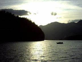
Above picture: Detroit Lake

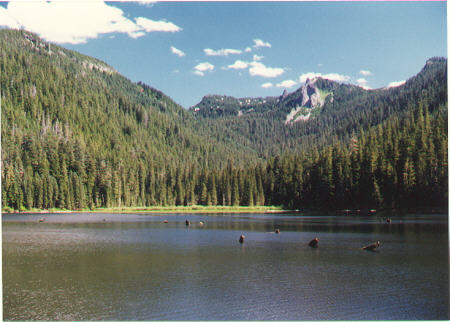
Above picture: Pamelia Oregon Coast

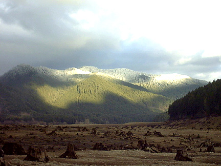
Above picture: Santiam Canyon
You can send a comment to the author of this story.
You can also read other stories by J.D. Adams
Copyright |
Privacy Policy |
Disclaimer |
Contact
The Santiam Highway was a single track, treacherous and forbidding, perched on the canyon wall where the Detroit Dam is today. The view dropping off into the canyon is still etched into the minds of old-timers. Turnouts were few, driving and negotiating skills were honed when two cars had to pass each other.
Detroit, originally named logging camp 17, was the hub of an extensive trail network that connected the Little North Fork with the North and Middle Santiam drainages. The Volcano Trail came northward from Quartzville Creek, offering spectacular views as it topped the ridgeline, descending to Blowout Creek and moving past the old Box Canyon Shelter. One of the suspension bridges that were used on this trail is still intact. The Byar’s Peak Trail has been largely bypassed by logging roads, but a faded tread still exists on the highest, windy reaches of the peak. Rising from a road now gated on the back streets of Detroit, the old Boulder Ridge Trail connected the Outerson Mountain Lookout with the Triangulation Peak Lookout, and continued into what is now the Jefferson Wilderness. The popular Tumble Creek Trail is a remnant of a route that allowed access to three fire lookouts and the Opal Lake Trail. Phone lines came down from the many fire lookouts in the area into Mill City, Detroit, and Idanha.
The town of Mill City began in 1887 with a sawmill relocated from Stayton, growing to become one of the largest mills on the west coast. I remember Mill City in the 50’s as a place of busy shops and growing families, vibrant with the wealth carried by rumbling log trucks. We lived in a neighborhood on the southwest edge of town, where houses had been built for engineers of the Detroit Dam project. The trail from the old Thomas Cairn Lookout came down almost into our backyard.
Idanha is an Indian word meaning Spirit of the Healing Waters, according to Lewis A. McArthur in Oregon Geographic Names. This town was the eastern terminus of T. Egenton Hogg’s Oregon Pacific Railroad line. The original name of Idanha was Muskrat Camp, later changed by the owner of a resort hotel formerly at the site. The name is mysteriously linked to an old Idan-Ha Hotel and Bottled Mineral Water Company in Soda Springs, Idaho.
The Santiam River had a trail on the south bank starting at Detroit that went up as far as Pamelia Creek. From here the Pamelia Lake Trail forked eastward. According to local legend, pack strings of horses carried hay bales in to the lake to dam the subterranean outflow and raise the water level. Also leaving the Santiam, the Minto Mountain Trail zigzagged up to Grizzly Lake and Lizard Lake, high on the top of Minto Mountain. Early generations of Oregonians found it a good camping spot with the mountaintop meadows and spring of water. In the early 1900s this trail merged with the Skyline Trail; famous author and drama critic Walter Eaton describes a journey along the trail in the book “Skyline Camps”, c1922. In 1896, Mountain guide Dee Wright scouted a northern section of the Skyline Trail, the predecessor to the Pacific Crest Trail. Premier northwest photographer Fred H. Kiser, who did the photographs for Eaton’s book, also blazed the Skyline Trail from Mt. Hood to Crater Lake in 1919. Prior to the 1964 designation of wilderness, you could drive within ½ mile of Marion Lake, where there was a boathouse, docks, and rustic cabins. Ornithologist Dr. A. G. Prill had a cabin on the north side of the lake of which only the fireplace hearth remains.
Many of these pioneer trails were old Indian trails, some still in use today. Underneath the Santiam Highway lies an Indian trail, a haunting presence felt in twilight moments, when past and present merge into the timelessness of the canyon. In the wind is the sound of a forgotten traveler, cresting a ridge of long ago.

Above picture: Detroit Lake

Above picture: Pamelia Oregon Coast

Above picture: Santiam Canyon
You can send a comment to the author of this story.
You can also read other stories by J.D. Adams